usage of VMS map f85/86
Posted: Sun May 11, 2025 11:28 am
Some here may know this explanation & video from another forum, so just the links, english version is not more than 19minutes long:
(fun fact: you can see the localisation and explanation of VMS map with aerial images and other only by watching a linked video, not here in this posting)
https://www.youtube.com/watch?v=yaOpdHT6qp4
russian version is quite longer due to language reasons, but with same content:
https://www.youtube.com/watch?v=LGRNCCjEps0 (also google-translated, native speakers may excuse it)
german version:
https://www.youtube.com/watch?v=QAsCZaIvrbE (die Ausgangsversion, ebenfalls länger, allerdings fehlen hier noch die 3D-Visualisierungen der Zelte, ca. Minute 10:00 in der englischen Ausgabe, bitte dort kurz reinschauen. Man lernt eben ständig dazu...)
Additional detail:
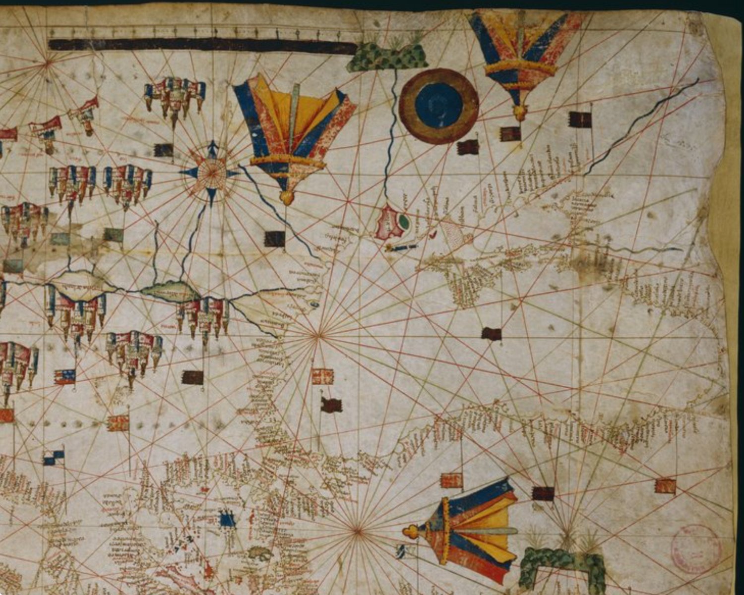
for those who are doubting the appearance of "huge tents" in a map, here is an example of exactly the timeframe ~1440s-1460s extracted from a map of known Petrus Roselli (complete here: https://commons.wikimedia.org/wiki/File ... _Noire.jpg)
Mind the dimensions, colouring, construction details and different perspectives of the tents north of Crimean peninsula and anatolya:
(fun fact: you can see the localisation and explanation of VMS map with aerial images and other only by watching a linked video, not here in this posting)
https://www.youtube.com/watch?v=yaOpdHT6qp4
russian version is quite longer due to language reasons, but with same content:
https://www.youtube.com/watch?v=LGRNCCjEps0 (also google-translated, native speakers may excuse it)
german version:
https://www.youtube.com/watch?v=QAsCZaIvrbE (die Ausgangsversion, ebenfalls länger, allerdings fehlen hier noch die 3D-Visualisierungen der Zelte, ca. Minute 10:00 in der englischen Ausgabe, bitte dort kurz reinschauen. Man lernt eben ständig dazu...)
Additional detail:
for those who are doubting the appearance of "huge tents" in a map, here is an example of exactly the timeframe ~1440s-1460s extracted from a map of known Petrus Roselli (complete here: https://commons.wikimedia.org/wiki/File ... _Noire.jpg)
Mind the dimensions, colouring, construction details and different perspectives of the tents north of Crimean peninsula and anatolya: